Google DeepMind unveils an AI model that acts as a "virtual satellite" for mapping the entire planet
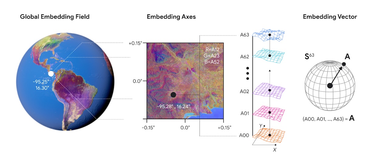
Google DeepMind has introduced AlphaEarth Foundations, an AI system designed to convert petabytes of satellite data into unified digital representations.
The goal is to boost the accuracy of environmental analyses and support better decision-making on issues like food security, deforestation, and water resources.
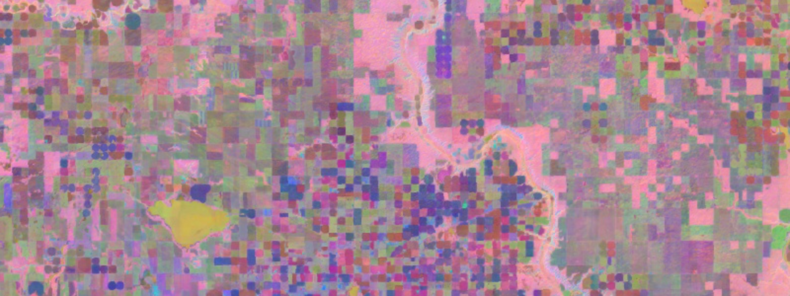
AlphaEarth Foundations acts as a "virtual satellite," characterizing all land masses and coastal waters on Earth at a 10x10 meter resolution. The model integrates multiple data sources, including optical satellite imagery, radar, 3D laser mapping, and climate simulations. These inputs are compressed into 64-dimensional embeddings - compact, data-efficient representations, according to DeepMind.
Training relied on over three billion observations from more than five million locations worldwide. AlphaEarth Foundations draws from satellite missions such as Sentinel-2 and Landsat, and also incorporates text sources like Wikipedia articles and species observations.
The system aims to tackle two core challenges: data overload and inconsistent information. It can see through persistent cloud cover, map intricate surfaces in Antarctica, and reveal subtle variations in Canadian agriculture that are invisible to the human eye.
In head-to-head tests against traditional approaches and other AI mapping systems, AlphaEarth Foundations achieved an average of 24 percent lower error rates, according to the research paper. The model outperformed all other methods across 15 evaluation datasets, covering land use classification, biophysical variable estimation, and change detection.
AlphaEarth Foundations also works in scenarios where little processed data exists, and its continuous temporal analysis allows for precise predictions across arbitrary time periods, even when those periods don't fully align with the input data.
The model's "Space Time Precision" (STP) architecture treats satellite images from a location over time like frames in a video. This lets the system learn spatial, temporal, and measurement-based relationships, generating embeddings that capture both local context and temporal trajectories.
Satellite images from irregular time intervals are arranged chronologically and transformed into continuous embeddings, providing seamless site views with measurement data. | Video: Google Deepmind
Real-World impact through global partnerships
More than 50 organizations are already testing the system in real-world applications. The Global Ecosystems Atlas uses the data to classify previously unmapped ecosystems into categories like coastal shrublands and hyper-arid deserts.
Nick Murray, director of the James Cook University Global Ecology Lab, says: "The Satellite Embedding dataset is revolutionizing our work by helping countries map uncharted ecosystems - this is crucial for pinpointing where to focus their conservation efforts."
In Brazil, MapBiomas is using the data to gain deeper insights into agricultural and environmental changes, especially in critical ecosystems like the Amazon rainforest.
Available as the Satellite Embedding Dataset
Google is making the annual embeddings available as the Satellite Embedding Dataset in Google Earth Engine. With over 1.4 trillion embedding footprints generated per year, it is one of the largest datasets of its kind. Annual embeddings from 2017 to 2024 are available under the Apache-2.0 license.
According to Google Earth Engine, the dataset unlocks several applications: similarity search for identifying comparable environmental conditions worldwide, change detection by comparing embedding vectors across years, automatic clustering without predefined labels, and smarter classification using much less training data.
Research grants to support scientific applications
Google is offering research grants of up to $5,000 to scientists to accelerate research and publications focused on Satellite Embedding use cases. Submissions will be accepted over the coming months.
The developers see AlphaEarth Foundations as a significant step toward "understanding the state and dynamics of our changing planet," and believe that combining it with general reasoning LLM agents like Gemini could enable even more powerful applications.
DeepMind has a history of using large datasets to track global developments. For example, its GenCast AI model showed major advances in weather forecasting at the end of 2024.
AI News Without the Hype – Curated by Humans
Subscribe to THE DECODER for ad-free reading, a weekly AI newsletter, our exclusive "AI Radar" frontier report six times a year, full archive access, and access to our comment section.
Subscribe nowAI news without the hype
Curated by humans.
- More than 16% discount.
- Read without distractions – no Google ads.
- Access to comments and community discussions.
- Weekly AI newsletter.
- 6 times a year: “AI Radar” – deep dives on key AI topics.
- Up to 25 % off on KI Pro online events.
- Access to our full ten-year archive.
- Get the latest AI news from The Decoder.